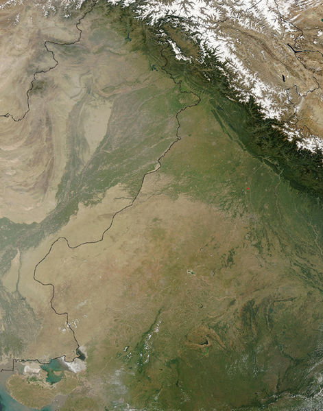
Сурет:Thar Desert satellite.jpg
Навигацияға өту
Іздеуге өту

Бұл алдын ала көрудің өлшемі: 471 × 599 пиксел. Басқа ажыратылымдықтар: 189 × 240 пиксел | 500 × 636 пиксел.
Түпнұсқа файл (500 × 636 пиксел, файл өлшемі: 329 КБ, MIME түрі: image/jpeg)
Файл тарихы
Файл сол кезде қалай көрінгенін көру үшін күн/уақыт дегенге басыңыз.
| Күн/Уақыт | Нобай | Өлшемдер | Қатысушы | Пікір | |
|---|---|---|---|---|---|
| қазіргі | 19:25, 2005 ж. қыркүйектің 17 |  | 500 × 636 (329 КБ) | Crux | Satellite Image of Thar Desert, India/Pakistan (border line in the middle) from en:, uploaded by en:User:Tom Radulovich |
Файл қолданылуы
Бұл файлды мына бет қолданады:
Глобалды файл қолданылуы
Бұл файл келесі басқа уикилерде қолданылады:
- ar.wikipedia.org жобасында қолданылуы
- az.wikipedia.org жобасында қолданылуы
- bg.wikipedia.org жобасында қолданылуы
- bn.wikipedia.org жобасында қолданылуы
- bs.wikipedia.org жобасында қолданылуы
- ckb.wikipedia.org жобасында қолданылуы
- de.wikipedia.org жобасында қолданылуы
- en.wikipedia.org жобасында қолданылуы
- eo.wikipedia.org жобасында қолданылуы
- es.wikipedia.org жобасында қолданылуы
- et.wikipedia.org жобасында қолданылуы
- fa.wikipedia.org жобасында қолданылуы
- fi.wikipedia.org жобасында қолданылуы
- fr.wikipedia.org жобасында қолданылуы
- he.wikipedia.org жобасында қолданылуы
- hu.wikipedia.org жобасында қолданылуы
- it.wikipedia.org жобасында қолданылуы
- ja.wikipedia.org жобасында қолданылуы
- ka.wikipedia.org жобасында қолданылуы
- kn.wikipedia.org жобасында қолданылуы
- ko.wikipedia.org жобасында қолданылуы
- ky.wikipedia.org жобасында қолданылуы
- lfn.wikipedia.org жобасында қолданылуы
- lt.wikipedia.org жобасында қолданылуы
- mai.wikipedia.org жобасында қолданылуы
- mg.wikipedia.org жобасында қолданылуы
- mk.wikipedia.org жобасында қолданылуы
- ml.wikipedia.org жобасында қолданылуы
- mr.wikipedia.org жобасында қолданылуы
- ms.wikipedia.org жобасында қолданылуы
- ne.wikipedia.org жобасында қолданылуы
- nn.wikipedia.org жобасында қолданылуы
- pa.wikipedia.org жобасында қолданылуы
- pl.wikipedia.org жобасында қолданылуы
- pnb.wikipedia.org жобасында қолданылуы
- pt.wikipedia.org жобасында қолданылуы
Бұл файлдың глобалды қолданылуын көбірек көру.

