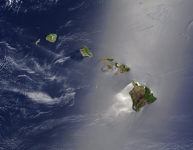
Сурет:Hawaje.jpg
Навигацияға өту
Іздеуге өту

Бұл алдын ала көрудің өлшемі: 771 × 600 пиксел. Басқа ажыратылымдықтар: 309 × 240 пиксел | 617 × 480 пиксел | 988 × 768 пиксел | 1280 × 996 пиксел | 2560 × 1991 пиксел | 3600 × 2800 пиксел.
Түпнұсқа файл (3600 × 2800 пиксел, файл өлшемі: 1,16 MB, MIME түрі: image/jpeg)
Файл тарихы
Файл сол кезде қалай көрінгенін көру үшін күн/уақыт дегенге басыңыз.
| Күн/Уақыт | Нобай | Өлшемдер | Қатысушы | Пікір | |
|---|---|---|---|---|---|
| қазіргі | 23:19, 2005 ж. қазанның 26 |  | 3600 × 2800 (1,16 MB) | Palladinus | Hawaii Islands |
Файл қолданылуы
Бұл файлға еш бет сілтемейді.
Глобалды файл қолданылуы
Бұл файл келесі басқа уикилерде қолданылады:
- arz.wikipedia.org жобасында қолданылуы
- bg.wikipedia.org жобасында қолданылуы
- ceb.wikipedia.org жобасында қолданылуы
- co.wikipedia.org жобасында қолданылуы
- en.wikipedia.org жобасында қолданылуы
- es.wikipedia.org жобасында қолданылуы
- fr.wikipedia.org жобасында қолданылуы
- fr.wiktionary.org жобасында қолданылуы
- gcr.wikipedia.org жобасында қолданылуы
- gl.wikipedia.org жобасында қолданылуы
- hr.wikipedia.org жобасында қолданылуы
- ky.wikipedia.org жобасында қолданылуы
- lv.wikipedia.org жобасында қолданылуы
- no.wikipedia.org жобасында қолданылуы
- oc.wikipedia.org жобасында қолданылуы
- pdc.wikipedia.org жобасында қолданылуы
- pl.wikipedia.org жобасында қолданылуы
- pl.wiktionary.org жобасында қолданылуы
- ro.wikipedia.org жобасында қолданылуы
- ru.wikipedia.org жобасында қолданылуы
- ru.wikinews.org жобасында қолданылуы
- sq.wikipedia.org жобасында қолданылуы
- sw.wikipedia.org жобасында қолданылуы
- to.wikipedia.org жобасында қолданылуы
- uk.wikipedia.org жобасында қолданылуы


