Сурет:IndianTerritory1885.jpg
Навигацияға өту
Іздеуге өту

Бұл алдын ала көрудің өлшемі: 792 × 600 пиксел. Басқа ажыратылымдықтар: 317 × 240 пиксел | 634 × 480 пиксел | 1015 × 768 пиксел | 1321 × 1000 пиксел.
Түпнұсқа файл (1321 × 1000 пиксел, файл өлшемі: 413 КБ, MIME түрі: image/jpeg)
| Бұл файл Wikimedia Commons? жобасынан, сондықтан басқа жобаларда да қолдануы мүмкін. Commons ашық лицензиялы медиа файл қоры. Сіз жобаға көмектесе аласыз. |
Ортаққордан қарау |
Түйін
| Сипаттамасы |
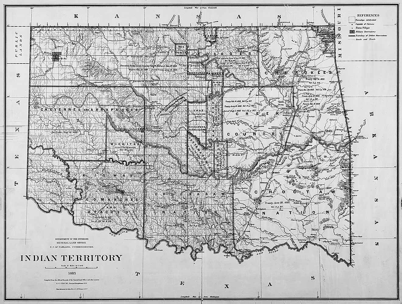
English: Map of Indian territory in Oklahoma in 1885. |
| Күні | |
| Көзі |
National Archives Federal Indian Policy, direct image here. Source claims the image is available in ARC with identifier NWDC-49-STP-IT1885, but cannot find it. |
| Авторы | General Land Office, U.S. Department of the Interior |
Лицензиялау
| This image or media file contains material based on a work of a United States Department of the Interior employee, created as part of that person's official duties. As a work of the U.S. federal government, such work is in the public domain in the United States. See the Department of the Interior copyright policy for more information. |  |
Файл тарихы
Файл сол кезде қалай көрінгенін көру үшін күн/уақыт дегенге басыңыз.
| Күн/Уақыт | Нобай | Өлшемдер | Қатысушы | Пікір | |
|---|---|---|---|---|---|
| қазіргі | 22:48, 2011 ж. маусымның 5 | | 1321 × 1000 (413 КБ) | Clindberg | {{Information |Description={{en|Map of Indian territory in Oklahoma in 1885.}} |Source=National Archives [http://www.archives.gov/education/lessons/fed-indian-policy/activities.html Federal Indian Policy], direct image [http://www.archives.gov/education/l |
Файл қолданылуы
Бұл файлды мына бет қолданады:
Глобалды файл қолданылуы
Бұл файл келесі басқа уикилерде қолданылады:
- ca.wikipedia.org жобасында қолданылуы
- es.wikipedia.org жобасында қолданылуы