Сурет:Oiyl District Kazakhstan.png
Навигацияға өту
Іздеуге өту

Бұл алдын ала көрудің өлшемі: 800 × 512 пиксел. Басқа ажыратылымдықтар: 320 × 205 пиксел | 640 × 410 пиксел | 1024 × 656 пиксел | 1280 × 819 пиксел | 1601 × 1025 пиксел.
Түпнұсқа файл (1601 × 1025 пиксел, файл өлшемі: 93 КБ, MIME түрі: image/png)
| Бұл файл Wikimedia Commons? жобасынан, сондықтан басқа жобаларда да қолдануы мүмкін. Commons ашық лицензиялы медиа файл қоры. Сіз жобаға көмектесе аласыз. |
Ортаққордан қарау |
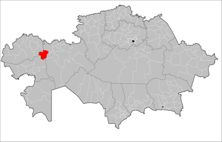
| Сипаттамасы | Map of the rayons of Kazakhstan. Created by Rarelibra 16:49, 3 August 2007 (UTC) for public domain use, using MapInfo Professional v8.5 and various mapping resources. |
| Күні | (UTC) |
| Көзі | |
| Авторы |
|
| This is a retouched picture, which means that it has been digitally altered from its original version. The original can be viewed here: Kazakhstan rayons.png:
|
Мен бұл туындының авторымын, келесі лицензия аясында бұны жариялаймын:
| I, the copyright holder of this work, release this work into the public domain. This applies worldwide. In some countries this may not be legally possible; if so: I grant anyone the right to use this work for any purpose, without any conditions, unless such conditions are required by law. |
Тұпнұсқа жүктеу журналы
This image is a derivative work of the following images:
- File:Kazakhstan_rayons.png licensed with PD-self
- 2007-08-03T16:49:43Z Rarelibra 1601x1025 (56761 Bytes) Map of the rayons of Kazakhstan. Created by ~~~~ for public domain use, using MapInfo Professional v8.5 and various mapping resources.
Uploaded with derivativeFX
Файл тарихы
Файл сол кезде қалай көрінгенін көру үшін күн/уақыт дегенге басыңыз.
| Күн/Уақыт | Нобай | Өлшемдер | Қатысушы | Пікір | |
|---|---|---|---|---|---|
| қазіргі | 10:15, 2011 ж. қыркүйектің 2 | | 1601 × 1025 (93 КБ) | Sibom | almaty |
| 22:41, 2011 ж. қыркүйектің 1 |  | 1601 × 1025 (94 КБ) | Sibom | up | |
| 19:49, 2009 ж. шілденің 18 |  | 1601 × 1025 (54 КБ) | Vipera | {{Information |Description=Map of the rayons of Kazakhstan. Created by Rarelibra 16:49, 3 August 2007 (UTC) for public domain use, using MapInfo Professional v8.5 and various mapping resources. |Source=*File:Kazakhstan_rayons.png |
Файл қолданылуы
Бұл файлды мына бет қолданады:
Глобалды файл қолданылуы
Бұл файл келесі басқа уикилерде қолданылады:
- bg.wikipedia.org жобасында қолданылуы
- el.wikipedia.org жобасында қолданылуы
- en.wikipedia.org жобасында қолданылуы
- fa.wikipedia.org жобасында қолданылуы
- fr.wikipedia.org жобасында қолданылуы
- it.wikipedia.org жобасында қолданылуы
- ru.wikipedia.org жобасында қолданылуы
- uk.wikipedia.org жобасында қолданылуы
- uz.wikipedia.org жобасында қолданылуы
- www.wikidata.org жобасында қолданылуы
- zh.wikipedia.org жобасында қолданылуы