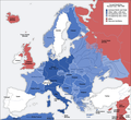
Сурет:Second world war europe 1941-1942 map en.png

Уикипедия — ашық энциклопедиясынан алынған мәлімет
Навигацияға өту Іздеуге өту

Түпнұсқа файл(1090 × 1000 пиксел, файл өлшемі: 216 КБ, MIME түрі: image/png)

Бұл файл Wikimedia Commons? жобасынан, сондықтан басқа жобаларда да қолдануы мүмкін.

Commons ашық лицензиялы медиа файл қоры. Сіз жобаға көмектесе аласыз.

Ортаққордан қарау Ортаққордан қарау
This military map image could be re-created using vector graphics as an SVG file. This has several advantages; see Commons:Media for cleanup for more information. If an SVG form of this image is available, please upload it and afterwards replace this template with {{vector version available|new image name}}.


It is recommended to name the SVG file “Second world war europe 1941-1942 map en.svg”—then the template Vector version available (or Vva) does not need the new image name parameter.
Maps of the history of Europe
BCE
aC

Weichselian ice age (c. 113,000–9700) · Neolithic expansion (c. 7000–4500) · Middle Neolithic (c. 4500–4000) · Late Neolithic (c. 4000–3000) · Copper Age – Corded Ware culture (c. 2900–2350) · Copper Age – Bellbeaker culture (c. 2800–1800) · Early Bronze Age – Unetice culture (c. 2300–1600) · Late Bronze Age – Urnfield culture (c. 1300—750) · Migrations (c. 1000–100) · Hallstatt & La Tène cultures (c. 800–100) · Roman Republic (510–40) · 220 · 218 · 200 · 201–100 · 58 · 49 · 39 · 30 BCE–6 CE


CE
dC

14 · 14–37 · 60 · 60 · 69 · 80 · Migrations 100–500 · 117 · 117 · 125 · Migrations 150–774 · Economy 180 · 271 · 293–305 · 337 · 395 · c. 395 · 400 · 400 · 450 · 457–61 · 476 · 480 · Franks 481–814 · Early Slavs 500–700 · 500 · 526 · 526–600 · Christianisation to 600 · c. 550 · 650 · Pontic Steppe 650 · 665 · 800 · Vikings 800–1050 · 814 · 843–70 · 850 · 900 · 912 · 998 · 1000 · 1000 · 1054 · 1092 · First Crusade 1095–99 · 1097 · 1135 · 1142 · 1147–49 · 1190 · 1190 · 1250 · c. 1250 · 1301-1400 · 1301-1400 · 1328 · 1345 · Black Plague 1347–51 · 1360 · 1400 · Trade routes c. 1400 · 1430 · 1470 · 1490 · 1492 · 1500 · 1519 · 1550 · 1560 · Religion 1560 · Religion 1600 · Religion 1618 · 1618–48 · 1648 · 1683 · 1700 · 1701 · 1708 · 1714 · 1721 · 1725–30 · 1739–1740 · 1740 · 1748–66 · 1783–1792 · 1787 · 1787 · 1789 · 1799 · 1812 · 1812 · 1812 · 1812 · 1813 · 1815 · 1815 · 1815 · 1818 · Ottoman Empire 1830–1923 · 1848–49 · 1861 · 1867 · 1871 · 1878 · 1890 · 1905 · 1911 · 1914 · 1914 · 1919 · 1919–29 · 1923 · 1929 · 1930 · 1940 · 1941–42 · 1942–45 · Cold War 1947–91 · 1950 · 1993–2006 · 2006 to date

(this template: · view · discuss )

Түйін

Annotations
InfoField
This image is annotated: View the annotations at Commons
Сипаттамасы
Deutsch: Karte der vom Deutschen Reich besetzten Gebiete und der Kriegsfronten im Zweiten Weltkrieg, 1941/42.
English: A map of German front of the Second World War circa 1941-1942.
Ελληνικά: Εδαφικές κατακτήσεις του Ράιχ
Español: Conquistas territoriales del Reich
Күні Original Image: 17 April 2005
Derivative Image: 22 December 2005
Көзі This file was derived from: Second world war europe 1941-1942 map de.png
Авторы Original Author: User:San Jose
Derivative Author: User:ArmadniGeneral
Рұқсат
(Бұл файлды қайта қолдану)
This image is a translation of the original, created and released under the terms of the GNU Free Documentation License.
Басқа нұсқалары

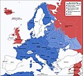
Derivative works of this file:  Großdeutsches Reich-europe.png [өңдеу]

Лицензиялау

GNU head Бұл файлды GNU Free Documentation License лицензиясының 1.2 нұсқасы бойынша немесе ескі Ашық бағдарламалық жасақтаушы қорымен жарияланған нұсқасының шарттарына сәйкес көшірмесін алуға, таратуға және/немесе өзгертуге болады. Лицензия көшірмесі GNU Free Documentation License деп аталынған бөлімде көрсетілген.
w:en:Creative Commons
атрибуция бірдей шарттарда тарату
Бұл файл Creative Commons Attribution-Share Alike 3.0 Unported лицензиясы бойынша қолжетімді.
Сіз келесі әрекеттерге еркінсіз:
  • бөлісу – туындыны көшіру, тарату және тапсыру
  • мазмұнын өзгерту – туындыны бейімдеу
Келесі ережелерді сақтағанда:
  • атрибуция – Авторлықты белгілеп, лицензияға сілтеме беріп, өзгеріс жасалғанын анықтауыңыз керек. Сіз мұны кез келген орынды жолмен істей аласыз, бірақ лицензиар сізді немесе қолдануыңызды мақұлдайтындай емес.
  • бірдей шарттарда тарату – Материалды араластырсаңыз, түрлендірсеңіз немесе құрастырсаңыз, үлестеріңізді түпнұсқамен бірдей бірдей немесе үйлесімді лицензия бойынша таратуыңыз керек.
Лицензияландырудың бұл қасиеті осы файлға GFDL лицензиясының жаңартылуының бір бөлігі ретінде енгізілген.

Captions

Add a one-line explanation of what this file represents
This map represents Europe in 1941-1942

Items portrayed in this file

суреттелген нәрсе

copyright status ағылшын тілі

copyrighted ағылшын тілі

MIME type ағылшын тілі

image/png

Файл тарихы

Файл сол кезде қалай көрінгенін көру үшін күн/уақыт дегенге басыңыз.

Күн/УақытНобайӨлшемдерҚатысушыПікір
қазіргі21:20, 2020 ж. тамыздың 521:20, 2020 ж. тамыздың 5 кезіндегі нұсқасының нобайы1090 × 1000 (216 КБ)Claude ZygielDistinguished statutes
06:00, 2018 ж. шілденің 2806:00, 2018 ж. шілденің 28 кезіндегі нұсқасының нобайы1090 × 1000 (184 КБ)JeffyPShrinking file size
13:06, 2009 ж. ақпанның 1613:06, 2009 ж. ақпанның 16 кезіндегі нұсқасының нобайы1090 × 1000 (214 КБ)Guinnog{{Information |Description=better titles |Source=*File:Second_world_war_europe_1941-1942_map_en.png |Date=2009-02-16 08:05 (UTC) |Author=*File:Second_world_war_europe_1941-1942_map_en.png: Sir Lothar *derivative work: ~~~ |Permission=see below
05:22, 2008 ж. сәуірдің 1105:22, 2008 ж. сәуірдің 11 кезіндегі нұсқасының нобайы1090 × 1000 (208 КБ)Sir Lothar
10:36, 2005 ж. желтоқсанның 2110:36, 2005 ж. желтоқсанның 21 кезіндегі нұсқасының нобайы1090 × 1000 (221 КБ)ArmadniGeneralA map of the Eastern front of the Second World War circa 1941-1942. The original German-language map was created by User:San Jose on 17 April 2005. It can be found here: Image:Second world war europe 1941-1942 map de.png. This image is a translat

Глобалды файл қолданылуы

Бұл файл келесі басқа уикилерде қолданылады:

Бұл файлдың глобалды қолданылуын көбірек көру.

Метадеректер