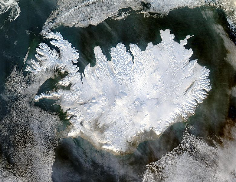
Сурет:Iceland satellite.jpg
Навигацияға өту
Іздеуге өту

Бұл алдын ала көрудің өлшемі: 780 × 600 пиксел. Басқа ажыратылымдықтар: 312 × 240 пиксел | 624 × 480 пиксел | 999 × 768 пиксел | 1280 × 985 пиксел | 2600 × 2000 пиксел.
Түпнұсқа файл (2600 × 2000 пиксел, файл өлшемі: 869 КБ, MIME түрі: image/jpeg)
Файл тарихы
Файл сол кезде қалай көрінгенін көру үшін күн/уақыт дегенге басыңыз.
| Күн/Уақыт | Нобай | Өлшемдер | Қатысушы | Пікір | |
|---|---|---|---|---|---|
| қазіргі | 10:49, 2004 ж. желтоқсанның 5 |  | 2600 × 2000 (869 КБ) | Ævar Arnfjörð Bjarmason | bigger version |
| 17:06, 2004 ж. қарашаның 6 |  | 540 × 405 (68 КБ) | Ranveig | NASA satelite image of Iceland |
Файл қолданылуы
Бұл файлды мына бет қолданады:
Глобалды файл қолданылуы
Бұл файл келесі басқа уикилерде қолданылады:
- af.wikipedia.org жобасында қолданылуы
- ar.wikipedia.org жобасында қолданылуы
- arz.wikipedia.org жобасында қолданылуы
- ast.wikipedia.org жобасында қолданылуы
- azb.wikipedia.org жобасында қолданылуы
- be.wikipedia.org жобасында қолданылуы
- bg.wikipedia.org жобасында қолданылуы
- bn.wikipedia.org жобасында қолданылуы
- ca.wikipedia.org жобасында қолданылуы
- ca.wikiquote.org жобасында қолданылуы
- ceb.wikipedia.org жобасында қолданылуы
- cs.wikipedia.org жобасында қолданылуы
- dag.wikipedia.org жобасында қолданылуы
- da.wikipedia.org жобасында қолданылуы
- de.wikipedia.org жобасында қолданылуы
- diq.wikipedia.org жобасында қолданылуы
- dz.wikipedia.org жобасында қолданылуы
- el.wikipedia.org жобасында қолданылуы
- en.wikipedia.org жобасында қолданылуы
- en.wikiversity.org жобасында қолданылуы
- es.wikipedia.org жобасында қолданылуы
- es.wiktionary.org жобасында қолданылуы
- fa.wikipedia.org жобасында қолданылуы
- fi.wikipedia.org жобасында қолданылуы
- fr.wikipedia.org жобасында қолданылуы
Бұл файлдың глобалды қолданылуын көбірек көру.

